
Our drone and LiDAR scanner are capable of flying over variable terrain and topography and can survey hundreds of acres per day. Our remote sensing team will work with you during flight planning and data processing to ensure that the goals of your study are met.
APPLICATIONS OF LiDAR DATA
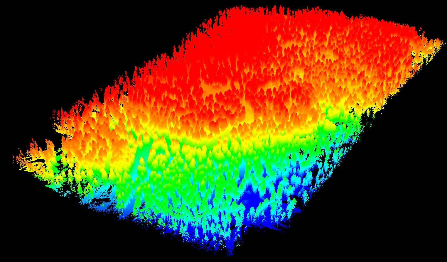
LiDAR (Light Detection and Ranging) data has proven to be vital in providing key information where aerial imagery and topographic data falls short.
The potential natural resources and forestry applications of LiDAR data include:
Creating digital elevation models
Bare-Earth terrain modeling
Canopy height modeling
Landslide and unstable slope detection
Flood risk management
Fuels assessment for wildfire mitigation
Cut and fill volume analysis
Tree species identification and disease monitoring
BENEFITS OF UAV-BASED LiDAR
Convenience and cost-effectiveness make UAVs a superior instrument in LiDAR data collection. Drones can easily survey smaller sites and more remote locations than conventional aircraft-based LiDAR.
UAV LiDAR data provides far denser point clouds and higher resolution models than typical aerial survey methods using manned aircraft. With our sensor, we collect UAV-based LiDAR data with up to 400 points per square meter. Higher point density allows greater flexibility in what can be accomplished with the dataset.